Alan Richey writes:
Following on from Mark Johnson's excellent article comparing Nokia Maps/Drive on the N8 and the Lumia 800, and also seeing Steve continually giving Nokia Maps the winners 'green block' in his phone comparisons, I thought it might be useful to do a more detailed comparison with other platforms. As a long time Symbian user I have been using Nokia Maps for as long as I can remember, first using a Nokia 5800 and then a Nokia C7. And it seemed to be peerless in every respect. But then I bought an iPhone 4 and within days my Symbian phones had been consigned to the drawer. But then I decided to go on an overseas driving holiday, so I brought the C7 back into service. I also decided it might be an idea to install a navigation system for my iPhone as a backup. Obviously I didn't want to have to pay much for it, and it also needed to have offline map storage as I was on pre-pay (pay as you go) on both phones and did not want to incur any data roaming charges while overseas.
I investigated the options on the iPhone, quickly rejecting Google Maps and Apple Maps (which both need to be online) and commercial apps such as Tom-Tom ($60), Navigon ($60) and Sygic ($25), but did come across NavFree GPS (also available for Android). It seemed to fit the bill for me, it was free (ad-supported), and it supported 25 different countries (UK, USA, France, Germany, Austria, Italy, Spain, Benelux, Switzerland, Australia, Portugal, India, Denmark, Estonia, Latvia, Lithuania, Portugal, Canada, Brazil, Sweden, South Africa, Mexico, Norway, Finland & Argentina). The map data comes from 'OpenStreets Maps' and the app has a built-in Map Feedback tool for users to submit corrections and then the company re-issue the maps every 6 months. This is perhaps not as good as Nokia Maps but it happened to suit my needs perfectly. So I decided to run them side by side, using the C7 with Nokia Drive/Maps as my primary device and have the iPhone running NavFree in my back pocket as a backup.
Just to confirm the specs, the iPhone was now running iOS6 (although I originally used NavFree with iOS5), the C7 was running Nokia Belle but not Belle Refresh (the '3' network take forever to allow updates through...) and Nokia Maps 3.09. I also happened to have a Nokia 710 with Windows Mobile 7.5 so did some of the tests on that as well. But like Mark, I found it inferior to the Symbian version so did not consider it as a replacement. And finally, just to be completely fair, I repeated all the tests on a Huawei G300 running Android 2.2 to see if the Android version of NavFree was the same. It turned out to be identical in every respect, so my comments apply to the Android version as well.
Initially I ran through all the settings to make sure everything was correct. Both systems have most of what you need, such as choice of measurement system, categories to be displayed, the route type to go for and whether to avoid motorways, toll roads, etc.
The next thing to do was to search for each destination and add them to my favourites. And here I ran into a personal 'niggle' with Nokia Maps. On earlier versions I could just go into the app, search for locations, add them to favourites, then start driving. Since then Nokia made the decision to split it into separate apps, and I believe it has become more difficult. I started in Nokia Drive and selected my destination (Kingston upon Hull Ferry terminal) and tapped on it. But I could find no way of adding it to my Favourites. You have to go into the separate app, Nokia Maps, if you want to do anything other than a simple journey and then back into Nokia Drive for the actual journey. I just don't understand why Nokia split the app into two parts. So I repeated the search in Nokia Maps using POI > Ferry Terminal and was able to add it to the favourites. Next I tried it with NavFree and, while the terminal wasn't in the POI database, it quickly found it using either the address or postcode option and gave me the option to add it to the Favourites.
Now, after the ferry crossing I was visiting some friends in Holland, so the next address was "Titus Brandsmastraat, Breukelen, Netherlands". First to try was Nokia Maps but I got the "Nothing found" message on both the C7 and the 710. On my iPhone, NavFree found it instantly and displayed a nice map of just the right scale showing me the location, an option to drive there and another menu of options to do lots of things with it (the two options off the bottom of the screen are "Set as my Position" and "Report a Mistake").
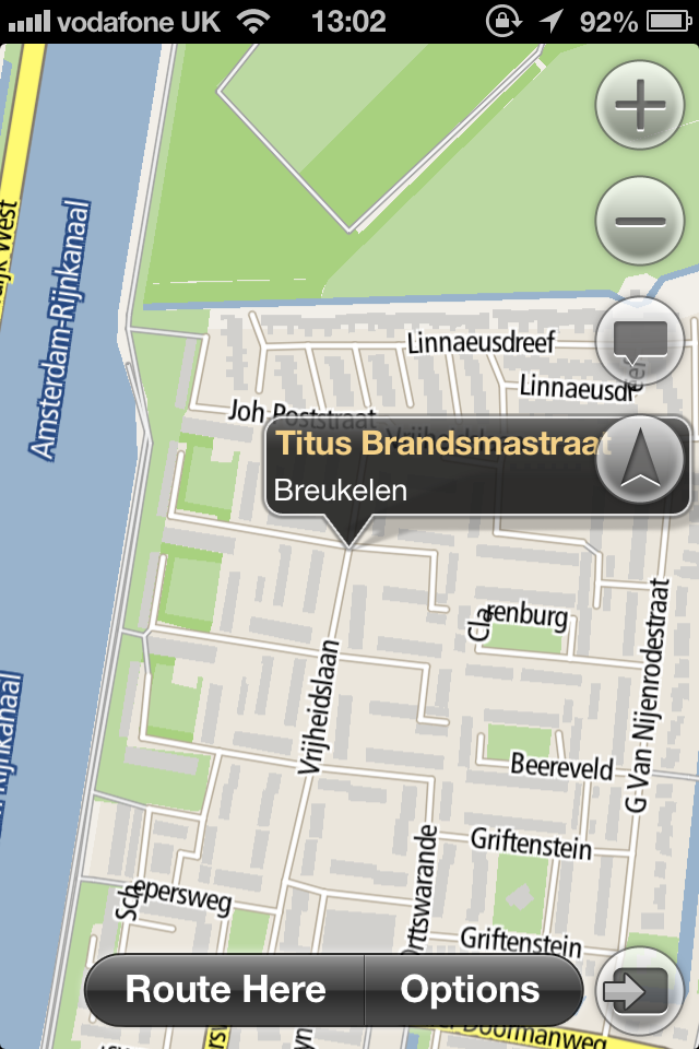
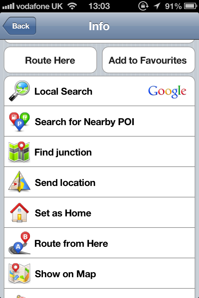
So now back to Nokia Maps and after a lot of experimenting I think I found the reason for the 'No found". It seems that, regardless of whether you specify the country in the search string, it starts the search in the same country as the last search. On the Nokia, after I selected a location in the USA and then did the search, it found a "Breukelen Court" somewhere in Ohio. Once I selected a unique point in the Netherlands (Europoort in Rotterdam), Nokia Maps seems to 'switch' to the Netherlands and then both systems subsequently found the location.
On Nokia Maps, after the roads appeared, the initial view was too wide and I had to zoom in quite a bit to make sure it was the right location. And while getting it into the Favourites was easy, I did not find it intuitive having to resort to scrolling, tapping and then using icons to do it. I prefer simple instructions.
Overall, on NavFree it took me just a few seconds to add a new location to my Favourites, in Nokia Maps it finished up taking several minutes. So overall, for searching and for pre-planning the trip I have to give it to NavFree.
Now I started to plan the route from my house in South Lincolnshire to the Hull Ferry Terminal. I know from experience the best route is up the A1, then the A46 to Lincoln then the A15 to Hull (with a short detour on the M180). The results were:
- NavFree appeared to give me the right route, at 92 miles and an elapsed time of 2.30 hrs
- The C7 took me East to the A15 and then North all the way to Hull. 82 miles and 2:00 hrs.
And as another check, Autoroute on the PC gave me the right route, but reckoned I could do it in about 1:50 hrs. So it's a slight concern that the C7 picked a completely different route to the other 3 systems, but I accept it was a perfectly valid route.
I drove the standard route and, as expected, fairly soon after departure, the C7 reverted to the same route offering 92 miles and 2:00 hrs.
In practice, the journey took 2:15 hrs so I guess there was no outright winner. Although I will actually give the prize to Navfree as I would prefer my system to be a bit pessimistic about travel time, to allow for traffic lights, traffic jams… rather than being optimistic and finding myself late for a check in.
So, it was time to leave. I had a cheap and cheerful USB charger to plug into the car cigarette lighter as I knew that using the GPS and having the display on permanently would quickly drain the batteries on both machines. Luckily it was fitted with 2 USB slots so I was able to charge both phones at the same time. Once we hit the road, both systems performed well, both gave quite nice views as shown:
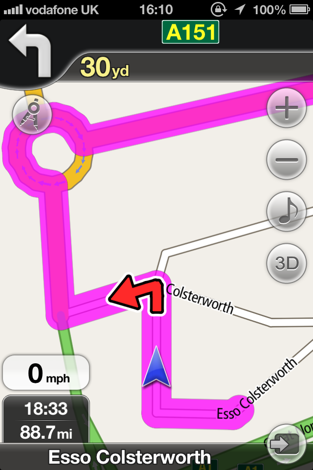
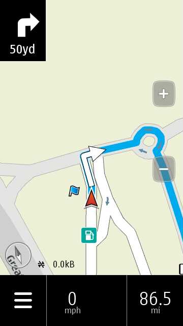
As far as screen information is concerned, Nokia Drive has gone for the minimalist approach, with context specific displays. It has just a Menu button, a compass, two zoom buttons, speed indicator, distance to next action, type of action and either Distance to Go, Travel Time or Time of Arrival, selectable by tapping on the display. At appropriate times, although not shown here, it also displays the speed limit, the present road at the bottom of the screen and as you approach a turn, the name of the new road at the top. NavFree has basically the same information, but does offer both Distance to Go and Arrival Time displayed at the same time rather than having to manually toggle between them, it always displays present road and next road and it adds 2 extra buttons, allowing you to select background music and 2D/3D maps without having to switch screens or apps. Although it displays more information, I don't find it in any way cluttered and actually prefer having both Distance to Go and Time of Arrival displayed and the next road all the time rather than just at the last minute. And I don't need the compass display so didn't miss it.
The main navigation displays are both good, although the NavFree one is perhaps more clunky and garish. However, I found that with my ageing eyes, I regularly had to resort to putting on my glasses to read the more elegant Nokia display whereas I could often see enough on the NavFree display to do without. It's obviously very subjective and can only ever be a personal viewpoint, but on balance I preferred the NavFree display.
One of things I did miss on NavFree was the speed limit display and warning, so Nokia Maps wins out there. I should also add that a Speed Camera overlay is available for NavFree as a paid option ($2.99).
Then, all of a sudden, as we were driving along the A46 towards the A15 junction, NavFree specified a completely illogical diversion. The days are long gone when I used to slavishly follow satnav directions, so I ignored it and turned onto the A15. After a quick recalculation, it knocked 15 mins off the time and both systems now showed the same arrival time. Analysis of the map afterwards showed the reason, in that NavFree shows the A15 as a one-way street at that point!
NavFree has a Map update tool (the icon that looks like a set of compasses) so I was able to report the error. Hopefully in the next update the A15 will revert to 2-way...
Obviously a big black mark against NavFree, although even if I had followed the original directions it would still have got me to the destination, albeit 15 minutes later.
One oddity was that, all of a sudden, the C7 went blank and switched off. I pulled off the road to find out what had happened. It turned out that at some point the 2mm power lead on the C7 had vibrated loose, but I had missed the "Unplugged charger" message on the screen. For some reason, the designers of Nokia Maps do not show the top status bar with the battery indicator when you are in the map display. Probably the one time when you absolutely need to know the phone is being charged. What were they thinking?
The next morning, after the ferry ride and on foreign soil, incredibly, the iPhone locked on and started giving us directions while we were still deep inside the ship on the car deck, no idea how it does that*. The C7 sat there with the "Waiting for GPS" message until about 10 minutes after departure (remember that data roaming was turned off). As it happens, there is only one route out of Europoort for the first 20 mins or so, so it didn't matter. But if I had landed at an airport and was using a Hire Car then the first few minutes of leaving the airport and starting the journey are absolutely crucial so I would have been totally stuck.
* Postscript: Alan now has a theory for this. On the ferry journey, he was wandering around with the iPhone in his pocket and, although he did not go outside, the ship did have big windows in the coffee bar. As he hadn't specifically shut down the NavFree app, it would have been suspended in the background and possibly keeping the GPS active. So the iPhone would have been keeping a GPS lock of some kind going and, when the app was resumed in the car, it just carried on from the position it had logged upstairs in the ferry. Whereas the C7 stayed in the car and was not only denied a sniff of the sky for the duration of the journey, it was also many hundreds of miles from its last known position when turned on again. So, starved of data for an Assisted GPS almanac grab, Nokia Maps would have had to wait for the C7's GPS to acquire the satellite positions almost from first principles, all over again.
If the C7 had also been in his pocket, turned on with Maps or Drive running in the background while upstairs on the ferry, it would also hopefully have resumed navigation immediately, etc.
Possibly. My additional theory is that the iPhone positioning for sat-nav uses also allows the less accurate cell tower triangulation, while Nokia Maps/Drive insists on a full GPS fix before making declarations about junction level instructions. So the iPhone got navigating quicker but the position was only approximate for a minute or two.
Comments welcome!
So I carried on the holiday driving around Holland and not surprisingly, the iPhone 4 with NavFree became my primary satnav with the C7 and Nokia Maps as the backup. In fact, after a few days I just didn't bother with the C7 and left it in the glovebox.
This is going to sound controversial, but the message I am trying to put across is that I had started this exercise confident that Nokia Maps was the best satnav system around and that anything I used on the iPhone would be an inferior product and only really of use as a backup. What I actually found in practice was that the NavFree software on the iPhone (or Android) was actually easier to use, more reliable, easier to read, and had all the functionality I needed, apart from speed limit display and warning, and with the exception of the A15 'one-way' glitch, never let me down.
I look forward to the comments this will inevitably generate!
Alan Richey
Steve (editor)'s afterword: it seems the world of third party 'open' navigation solutions for other platforms has indeed come on apace in recent times, so thanks for the real world data points, Alan. Nokia Maps has indeed been a bit finicky with finding things, so I'm not surprised you had issues there. And no, I've no idea why Nokia split Maps and Drive either!
The idea of using a GPS system without any data involvement at all (once maps are loaded) is a nice idea, once you've allowed a few minutes for the GPS in the phone to 'find' the satellites again without any help from online almanacs. And it goes without saying that you shouldn't move ANY such device a large distance while turned off, otherwise you've got to wait while the GPS satellite data is gathered all over again!
No hay comentarios:
Publicar un comentario